A History of Kilton, North Yorkshire
A history of Kilton and Kilton Thorpe in North Yorkshire from
prehistoric times to a thriving Georgian agricultural community, through a
period of Victorian change, to the twenty first century
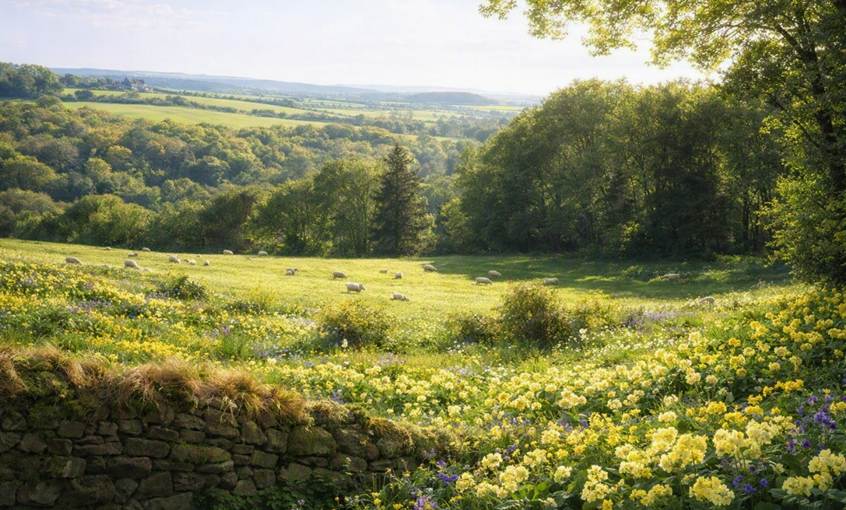
No place can equal Kilton for loveliness standing as it does in the midst of sylvan scenery, beautiful landscape and
woodland scenery and what a perfume of sweet fragrance from wildflowers,
particularly the primrose-acres that would grace any gentleman’s pleasure
ground for beauty and for loveliness. Kilton, as it is situated, is fitted only
for a prince (John Farndale, 1864)
|
Return to the Home Page of the Farndale Family
Website |
The story of one family’s journey through two
thousand years of British History |
The 83 family lines into which the family is divided.
Meet the whole family and how the wider family is related |
Members of the historical family ordered by date of
birth |
Links to other pages with historical research and
related material |
The story of the Bakers of Highfields, the Chapmans,
and other related families |
Kilton was the heart of the Farndale family story for
two hundred and fifty years.
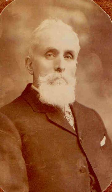
Charles Farndale of Kilton Lodge
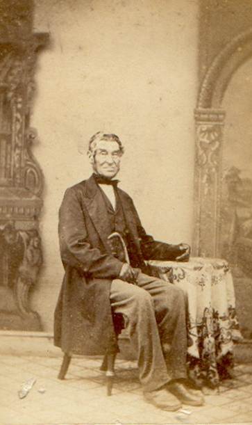
John Farndale who wrote about
Kilton in the late nineteenth century
This page provides a chronological history of Kilton, with
detailed research notes, for all those with an interest in this remarkable
place. If you find this page helpful, or if you have further information to
share, please email the author, Richard Farndale, at rcfarndale@hotmail.com.
For ease of navigation:
Chapter headings
and sub headings are in brown.
Dates are in red.
Links to other
pages are in dark blue.
References and
citations are in turquoise. References
include links
to the original source material, where available.
Introduction
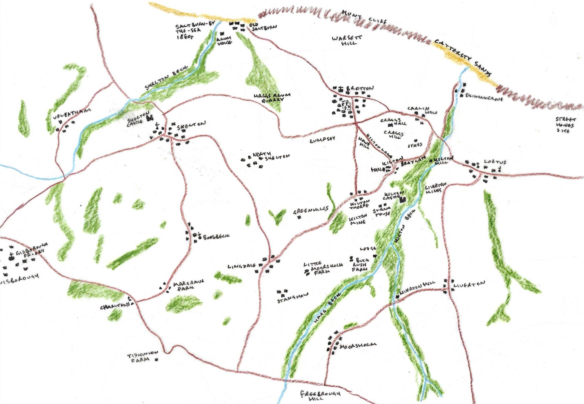
Kilton is a lost settlement, with a remarkable history, in the civil
parish of Lockwood (Lockward Parish
information), within the borough of Redcar and Cleveland (Redcar and Cleveland Council, Mapit
boundary map) in the County of North Yorkshire, in medieval times within
the Wapentake of Langbaurgh. Once a thriving settlement, Kilton today comprises
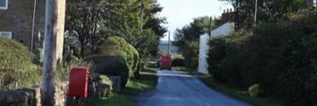
mostly farmland, with a small residential settlement at Kilton Thorpe. To the east is the narrow ravine
of the Kilton Beck Valley through which the Kilton Beck flows towards the sea
at Skinningrove. In the midst of the heavily wooded
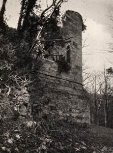
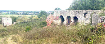
area of that valley lie the ruins of Kilton
Castle. About two kilometres to the north is the town of Brotton and Carlin How and Craggs Farm. To the south of Kilton Thorpe there are the scrag heaps and
disused buildings of the industrial graveland of the old ironstone mines.
Hidden behind a contemporary agricultural scene, lie clues to Bronze Age
and Anglo-Saxon Settlement; Norman fortification; a thriving Georgian village;
and profound agricultural change in the nineteenth century.
My great x3
grand-uncle, John Farndale wrote
that no place can equal Kilton for loveliness, standing as it does, in the
midst of sylvan scenery, beautiful landscape and woodland scenery, and what a
perfume of sweet fragrance from wild flowers,
particularly the primrose-acres that would grace any gentleman’s pleasure ground
for beauty and for loveliness. Kilton, as it is situated, is fitted only for a
prince.
We believe Kilton
had the pre-eminence of many of its neighbouring villages. We knew no poachers,
no cockfighters, no drunkards, or swearers. Kilton people were church-going
people, yet, on a Sunday afternoon, what hosts of young men and young women
mustered for play, their song was:
There is little
Kilton, lies under yon hill,
Lasses anew lad,
come when you will;
They’re witty, they’re
pretty, they’re handsomely bound,
A lo! for the
lasses in Kilton town
(Farndale, John. 1870. The History
of Kilton With a Sketch of the Neighbouring
Villages By the Returned Emigrant. Middlesborugh: Burnett and Hood).
He also wrote
that Kilton stands unrivalled for its antiquity, and its beautiful scenery
cannot be excelled. The brightest and fairest scenes in Italy cannot be
compared to the lovely prospects which Nature displays in this secluded part of
Cleveland. This place stands on a ridge of rich loamy land, with Huntcliffe on the north, known to all sea-men.
On the east is the beautiful bay of Skinningrove and the hall of A C Maynard
Esq, formerly the residence of F Easterby Esq.
Skinningrove was once a noted place for smuggling. On the north
west is Old Saltburn which was formerly considered the King of the
Smuggling World. Near which is New Saltburn, about to become one of the most
fashionable sea bathing places on the eastern coast, thanks to the enterprising
gentlemen who conduct the railway operations in this neighbourhood, and who are
the public’s benefactors, in a commercial, social point of view, and are
indeed, in every sense of the word, the friends of the people. (A Guide to Saltburn by the Sea and the Surrounding
District, With remarks on its picturesque scenery,
Fifth Edition, Dedicated to John Thomas Wharton Esq of Skelton, By John Farndale.
Late of Skelton Castle Farm, Darlington, Printed by Charles W Hird, 1864, page
11).
Kilton
was of great interest with a great hall, stable, plantation, and ancient
stronghold in ruins (Kilton Castle). It is still a small place he says
and he described how many have left it and made their name. (John Farndale’s Memoires)
In
1913, in a less romantic style, William L’Anson wrote that the Kilton Beck,
which flows into the North Sea at Skinningrove, rises some five or six miles
inland, in a wild and lonely region of moorland 800 to 900 feet above sea
level, and taking, with many windings, a northerly course, and being augmented
by the waters of two or three other becks, flows rapidly seawards down a
beautiful and picturesque dingle or ravine. In fact Kilton Beck flows from
two higher becks which join about one kilometre upstream from the castle: Hagg
Beck which drains from Moorsholm Moor and Liverton Beck. Liverton Beck becomes
Mill Beck further upstream and is fed by Stubdale Beck which flows from
Liverton Moor and Skate Beck which flows from Gerrick Moor. Some four miles
from its source, in one of a series of
bold and graceful curves, it sweeps round the foot of a precipitous headland
projecting outwards some 180 feet above the beck on the left or western side of
the ravine. On the summit of this narrow ridge, which seems specially designed
by nature for the site of a small medieval fortress, Pagan Fitz-Walter, the
second holder of what subsequently became known as the Fief of Kilton in the
Barony of Percy, founded, in the reign of King Stephen, the little-known castle
of Kilton. (Kilton Castle, William M
L’Anson, Yorkshire Archealogical
Journal, Volume 22, 1913, page 55). It was
in fact more likely to have been Robert de Brus who built Kilton Castle, in the
time of King Stephen.
Within
the fiefdom, later the estate, and now the farmlands of Kilton, there are
antique features, which each hide a rich history.
This
chronology is accompanied by separate pages which explore aspects of Kilton and
its history in further detail.
|
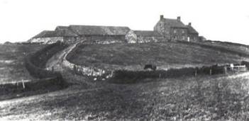
The medieval settlement with Iron
or Bronze Age roots, referred to in the Domesday Book alongside Kilton |
In romantic and picturesque grandeur,
few ruins in England can equal this venerable relic of antiquity. |
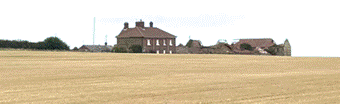
The Georgian Hall, the centre of
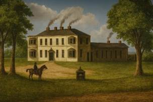
the community, later rebuilt |
A medieval farmstead which evolved
into an important Victorian farm |
A medieval farmstead, which is
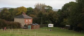
still a farm today |
An antique farmstead on Kilton’s
central landscape |
|
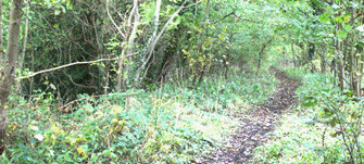
The dense woodland to the east of
Kilton with very steep slopes to Kilton Beck, and which hides the medieval
castle |
A mill is noted at Kilton in 1323 and 1344. |
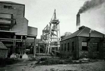
The ironstone mine which operated
from 1871 to 1963 |
A site of medieval agriculture and
a mine from 1881 to 1954 |
Three fields which lie on a
medieval trackway from Kilton |
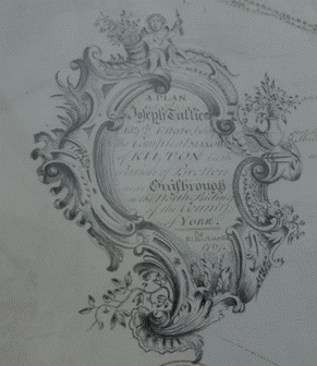
The remarkable detail from the
1767 Estate Map showing a stage in the gradual evolution into modern Kilton |
A Chronological History of
Kilton
There is evidence
of dispersed settlement in the vicinity of Kilton dating to prehistoric times.
9,600
to 4,000 BCE
Mesolithic Hunters
The Mesolithic is
the period prior to the commencement of farming, when hunters and gatherers
roamed to plains and hills of Yorkshire. Tools of stone and flint show that
humans were in this area, surviving by hunting and making temporary camps.
There is
extensive evidence of Mesolithic activity in the vicinity of the North York
Moors particularly in the uplands and in the watery world of the Vale of
Pickering, including at Star Carr.
Mesolithic finds in Cleveland evidence Mesolithic activity, though the finds
are more limited. See for instance Daniels, Robert.
2015. The
Mesolithic in North East Yorkshire. Tees
Archaeology.
Flint scatters
and arrowheads, including a 5,000-year-old ripple-flaked oblique arrowhead
discovered near the Carr Ponds on the Eston Hills, evidence human activity,
hunting, and travel routes across the northernmost edge of the uplands
overlooking Teesside (Neolithic Journey, Eston
Hills arrowhead is well-travelled!, Cleveland
Archaeology Trust; Ice and Fire, Eston Hills
Rescue Archaeology, Spencer Carter, 2017).
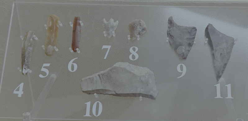
Flint tools (Dorman Museum, Middlesbrough)
Skeletons of wild
ox and deer have been found in peat bogs just a few miles from Skelton and have
been dated to around 7,000 BCE. It has been suggested that layers of charcoal
are the result of human activity (Skelton-in-Cleveland
History, 12,000 BC to 410 AD, the Late Bill Danby).
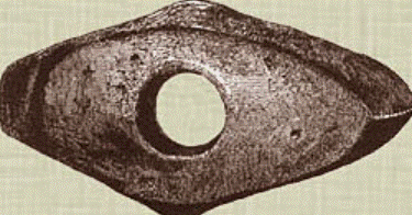
Hammer-axe of
Greenstone, from a ‘houe’ on Skelton moors
There have been
some Mesolithic finds of flints around Seamer Carrs
to the west of Stokesley (not to be confused with Seamer Carr near Star Carr), including a tranchet
flint axe (Rowe, Peter. 2015. Hunting
the Hunter-Gatherers, Mesolithic Teesside, Historic England),
but no concentration which might indicate seasonal camps.
Mesolithic
visitors in this area may have been seasonal visitors to small lakes in this
area. As the weather improved during the later Mesolithic period there was
increased activity across the uplands, including around the Upleatham Hills. (Spratt, D A. 1979. The Archaeology of
Cleveland).
Steve
Sherlock,
during his archaeological excavations at Street Houses Farm in September 2026
explained that most of the region was forested during the Megalithic. It seems
likely that there may have been Mesolithic activity along the coast. There is
no evidence yet of Mesolithic activity at Kilton, though it seems likely that
the area may have begun to encounter human activity, through dense forest and
perhaps in clearings.
c 3,800
BCE
Neolithic
Farming and industry
The many burial
sites or howes on the hills around Skelton
provide the first substantive evidence of humans in these parts. Neolithic
people began farming and living in settled communities. They clearly believed
in an afterlife and buried their dead in long barrows,
communal tombs covered with a mound of stones. These graves are found on high
ground and thought to be connected with sun and
ancestor worship. Cremation had often taken place and the remains buried with
items of jewellery, weapons and articles of daily life.
In Cleveland,
these more permanent settlements began primarily to emerge on the coast, with
access to seaborne transport.
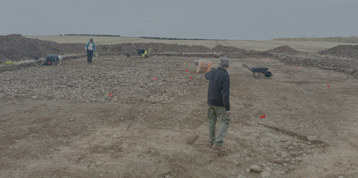
There have been
extraordinary Neolithic finds excavated Street Houses Farm site, only four
kilometres to the northeast of Kilton, above the cliffs overlooking the North
Sea. The excavations at Street Houses began in the 1930s by William Hornsby. A
Neolithic cairn was excavated by Blaise Vyner in 1981. Further sites were excavated
by Steve Sherlock from 2014 and the work is ongoing. The excavations include a
ring ditch, a possible Neolithic house, a mortuary complex and a cairn. This coastal
hilltop site is a regionally significant centre of early Neolithic life dating
to approximately 3,800 BCE. Evidence of hearths, broken pottery, and storage
pits suggests this is the earliest Neolithic salt-making site discovered in
Britain. Because salt was a highly valued, essential commodity for preserving
meat and dairy through the winter, this site suggests that early farmers
operated a more efficient, larger-scale cattle economy than previously thought.
A multiphase Neolithic cairn with a burnt timber façade and mortuary structure
was used for the deposition of cremated human remains. A Late Neolithic
palisaded ritual monument known as the Wossit
is located a short distance from the cairn. This roughly 6,000-year-old Neolithic
hub predates Stonehenge by over two millennia and is among the earliest found
in Western Europe. The activity at nearby Street Houses is indicative of
agricultural activity in the vicinity.
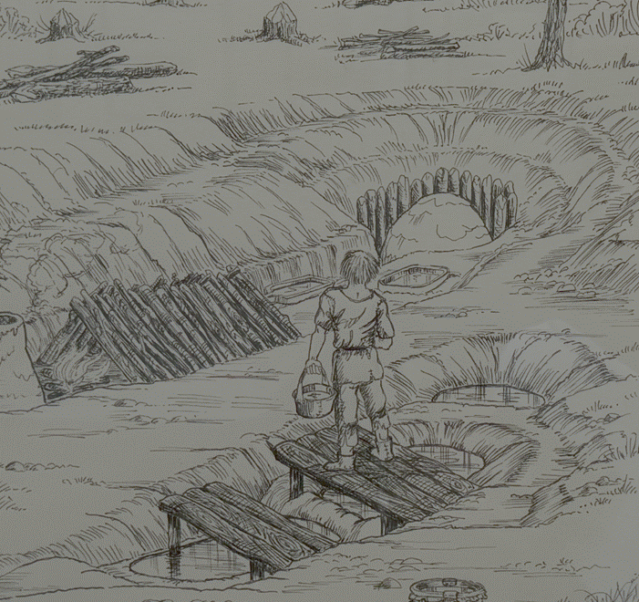
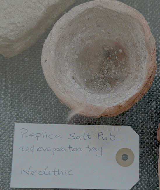
Salt making at
Street Houses
The rich history
of the Street Houses Farm site, so close to Kilton, which must have been a
significant influence on Kilton’s earliest history, is told in more detail on a
separate page.
|
The Street Houses Farm
Excavations
Further
detail about the Neolithic, Bronze Age, Iron Age, Roman-British
and Anglo-Saxon archaeology at Street Houses Farm |
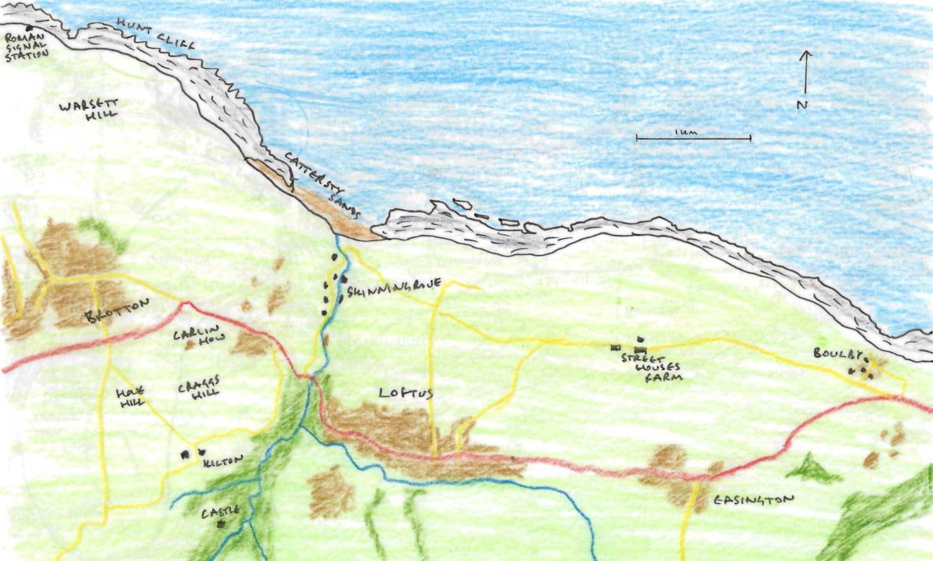
Kilton and its
relationship to Street Houses and Warsett Hill, also showing the location of
the Roman signal station
c 1500
BCE
The
Bronze Age Settlement Pattern
The largest single group of
prehistoric monuments in the county of Cleveland is the Bronze Age burial
mounds. Although there are remains of over 100 of these mounds within the county,
their distribution is markedly restricted to the high land, usually over 150
metres OD, to the South of the River Tees. Within this area, the main
concentration of burial mounts is on the present day moor lands of the
Cleveland and Eston Hills. (Crawford,
G M. 1990. Bronze Age Burial Mounds in Cleveland. Cleveland County
Council).
Whilst the Street
Houses site close to Kilton continued to be a centre of Bronze Age
significance, evidence of human activity emerged in Kilton.
On Kilton Lane south
of Brotton at NZ 695188, adjacent to Craggs Hill, is Howe Hill. This was the
site of an Early Bronze Age barrow. Here a burial was discovered in a tree
trunk coffin. The coffin had decayed badly when it was discovered and the
remains of a skeleton was associated with the coffin, with bones and a
brachycephalic (ie unusually short and wide) skull.
The tree trunk coffin was similar to another found on Gristhorpe cliff between Scarborough and Filey. Similarities
with coffins in Denmark suggested these were incomers, though this has since
been doubted. It may be that these were individuals who were simply using local
forest resources, similarly but independently from Danish practice.
Nevertheless, the coffins are suggestive of dugout canoes, which may indicate
that these were indeed incomers across the North Sea, or folk used to travel on
waterways. They may have been sea-faring folk. The resource required to shape such
a coffin was significant, suggesting domination by significant beliefs. In the
barrow there were many cupstones, including one where there were hollows within
rings.
The site was
excavated by William Hornsby and Richard Stanton in 1917. The Dorman Museum in
Middlesbrough displays important Bronze Age barrow artifacts, including log
coffins from the Loose Howe mound excavation at the head of Rosedale and local prehistoric
finds curated by former museum curator and archaeologist Frank Elgee.
Surveys by
antiquarians and archaeologists like G M Crawford in 1980 noted the fading
profile of the site. It is now barely visible as a low swell beside the Brotton
to Kilton road.
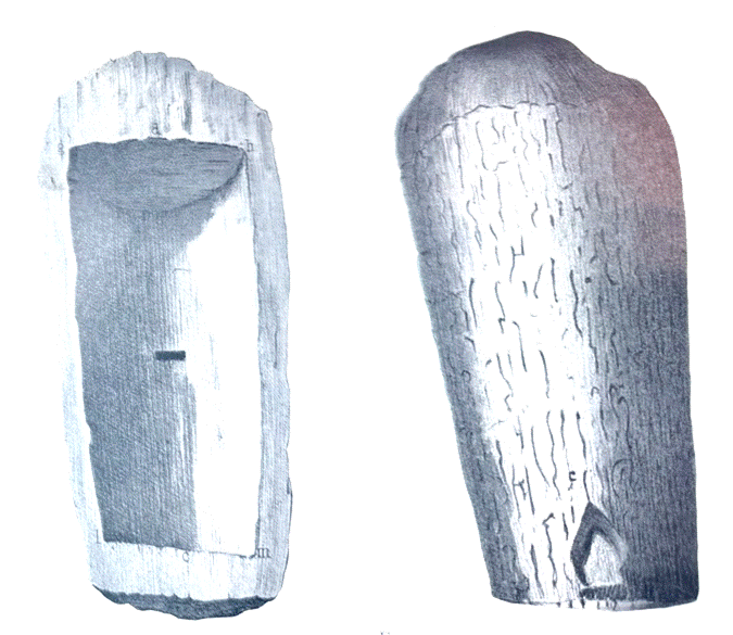
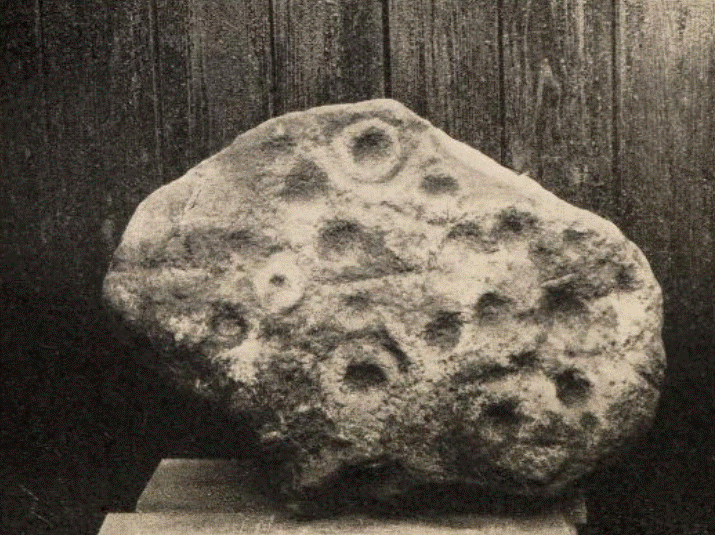
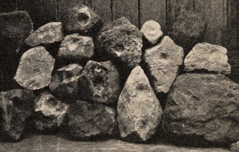
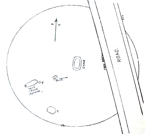
Tree-trunk
coffin, Gristhorpe
Cup and ring stone, Howe Hill, Kilton Eight
stones with cup marks, Howe Hill, Kilton Barrow at Howe Hill,
Kilton
(Elgee, Frank. 1930. Early Man in North-East
Yorkshire. Gloucester: John Bellows. Page 73-76).
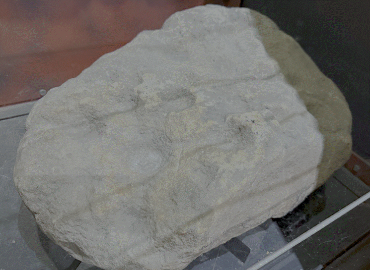
Cup and Ring Stone from Howe
Hill (Dorman Museum,
Middlesbrough)
Early men certainly knew
this beautiful part of England, for a coffin hollowed out of the trunk of a
massive oak which had been split lengthwise was found at Brotton in a barrow at
a place the local people called Howe Hill. In the coffin was the skeleton of a Bronze
Age man who lived in the district, 2000-1,500 BC. A second barrow was
discovered on the summit of Brotton Warsett Hill, to the east of Saltburn.
Around the barrow was a circular wall of stones, one foot high, and about three
feet in width. The body had been cremated and a food vessel placed over it.
There was also another vessel on the south side of the barrow. (Horton, Minnie C. 1979. The Story of
Cleveland, History, anecdote and legend. Cleveland County Libraries. Page
373).
This carved stone from the
Neolithic period, possibly up to 8,000 years old, was found at a barrow at Howe
Hill in 1913. Many hundreds of stones with hemishephrical depressions
surrounded by rings have been found on the North Yorkshifre Moors. Their meaning
is unknown. We can only speculate that they may have marked significant events
such as births or deaths. (Dorman
Museum, Middlesbrough)
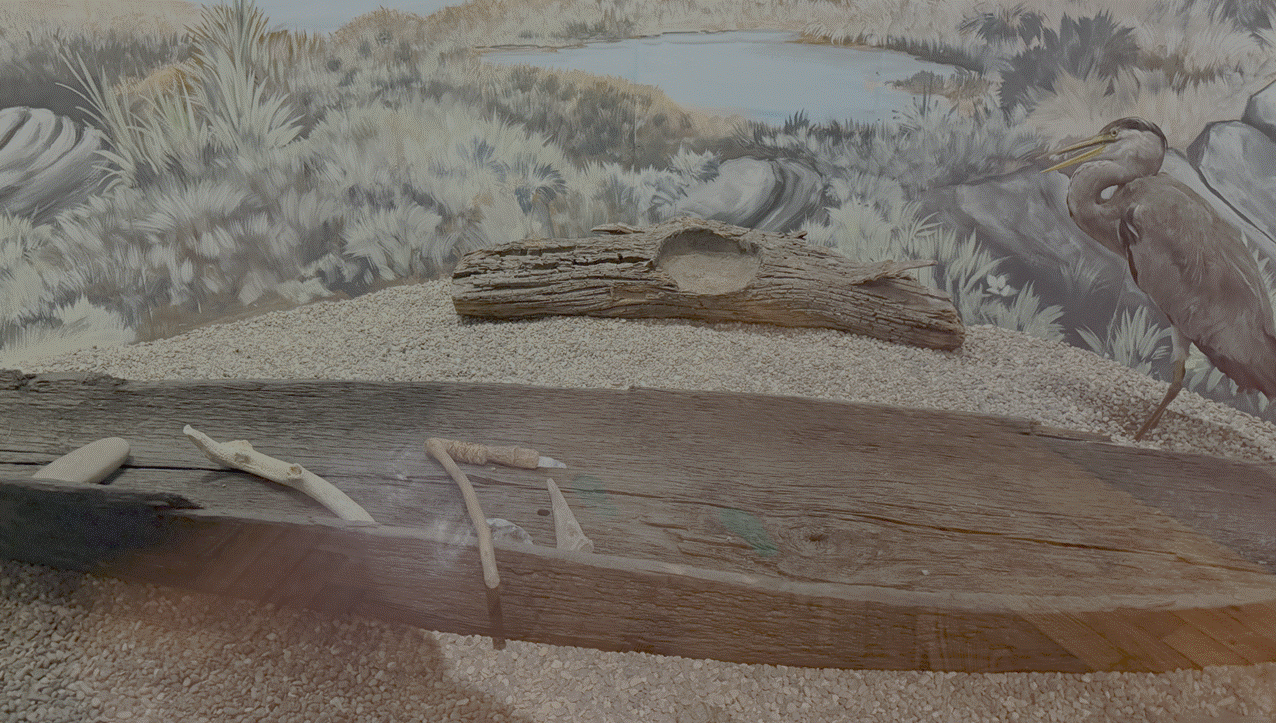
A dug out canoe discovered
in 1926 in the River Tees oppositie Thormanby High Wood, at a depth of 7 to 8
feet below the sand. The canoe is approximately 3,000 years old and was hewn
from a single oak trunk, showing a high level of workmanship, and there are
still traces of the fire which helped to hollow it out. The bottom is pierced
with three circular holes, each fitted with a cylindrical plug, which were
probablyu used to drain out any water when it had been brought on land. (Dorman Museum, Middlesbrough)
Another seven barrows were
found at nearby Warsett Hill on the cliffside north of Brotton, a group of
seven hillocks in the Beacon Field. It has been suggested that the Warsett
ridge was part of a natural line of communication between the moors and the
sea. There may have been a line of barrows of which Howe Hill may be a rare
survivor. Howe Hill may have been a part of a ritual landscape. A large slice
of the Howe Hill barrow was cut off when the road was built. As well as the cup
and ring stone, there was a pile of stones with cup markings. The cups probably
had religious significance. (Hornsby,
William and Stanton, Richard. 1918. British Barrows near Brotton in
Yorkshire Archaeological Journal Volume 24 Page 263-268).
The seven Warsett Hill
mounds were opened up by Canon Atkinson and later excavated in 1917 by W
Hornsby and R Stanton. These mounds occupied a central ridge and were
intervisible. The large barrow at Howe Hill is now only visible as a low swell in
an arable field at 140 metres above Ordnance Datum (“OD”, measured from the
Newlyn Tidal Observatory in Cornwall, roughly equating to mean sea level). The
barrow would have originally measured about 20 metres in diameter. Howe Hill
had been excavated by Hornsby and Stanton in 1914. (The Burial
Mounds at Brotton and Boulby in Crawford, G M. 1990. Bronze Age Burial
Mounds in Cleveland. Cleveland County Council pages 18-22).

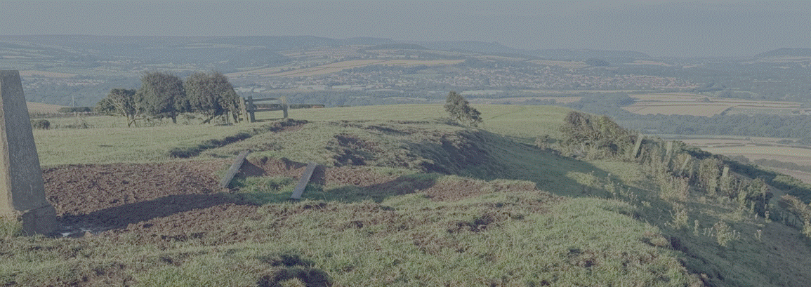
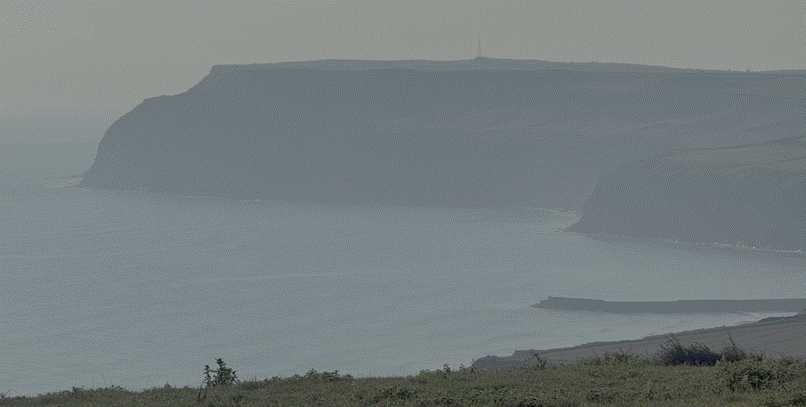
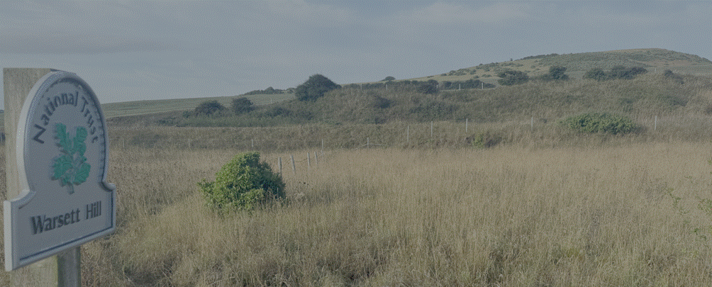
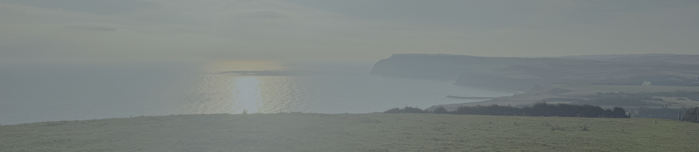
Warsett Hill 2026 (by the
author)
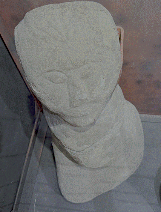
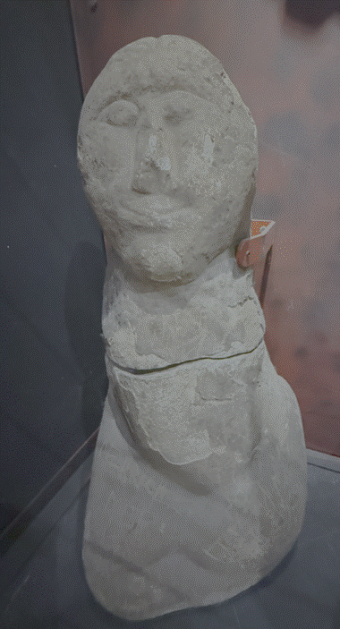
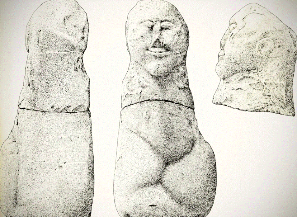
This fertility statue is an
unusual monument carved during the Bronze Age, up to 4,000 years ago, found on
Saltburn beach. The form seems to be a pregnant woman and may have been a
tribal fertility symbol or deity. (Dorman Museum,
Middlesbrough)
The figure was reputedly
found at the foot of Huntcliff in 1886 and was placed on a pedestal outside of
the nearby Ship Inn. In 1980 it was moved to the Dorman Museum in Middlesbrough
where it can be seen on display. Headley Swain commented that the Saltburn figure
probably qualifies as Celtic through default, although it could possibly be of
Romanesque origin. (The
Smell of Water, Swain, Headley (1995), Talking heads: three ‘Celtic’ heads
from East Cleveland in Moorland Monuments, CBA Research Report 101).
600 BCE
Iron
Age Settlement
An initial
pattern of dispersed settlement of individual farmsteads emerged in prehistory,
which led, by the Iron Age, to increased nucleation or concentration into a
tightly clustered settlement (Robert Daniels. 1990.
Kilton: A Survey of
Moorland Fringe Township in Medieval Rural Settlement in North East England. Architectural and Archaeological
Society of Durham and Northumberland Research Report No 2, edited by B E Vyner,
page 33).
The use of iron for tools
and weapons was introduced. Some historians say tribes of Celts displaced their
predecessors at about this time. There were perhaps intermittent movements of
people across the North Sea, as this was to be the pattern for the future. The
use of iron made it possible to farm the heavier soils of the lowlands. There
is no evidence of settlements in the earlier Iron Age period, which would have
been of timber and thatch, but the Iron Age people built earthworks on high
positions for defence and remains of these can still be seen.
100 BCE
The Tees valley was
a place of agricultural revolution during the Iron Age. Agricultural practices,
such as crop choice and processing, varied geographically, reflecting distinct
subregional identities and differing scales of arable production. (van der Veen, Dr. Marijke. 1992. Crop
Husbandry Regimes: An Archaeobotanical Study of Farming in Northern England
1000 BC - AD 500, Sheffield Archaeological Monographs 3).
A 2002 archaeological
excavation at Kilton Thorpe revealed a regionally significant Later Iron Age
open village with no enclosing bank or ditch (2002.
Sherlock, Stephen. An Archaeological Excavation at Kilton Thorpe, Nr
Brotton. Johnson, P, & Sherlock, SJ. Excavation of an Iron Age open
settlement at Kilton Thorpe, Brotton. 2010. Sherlock, Stephen John. An
Examination of Late Prehistoric Settlement in North East England with Specific
Emphasis on the Settlements of the Tees Valley. University of Leicester, School of
Archaeology and Ancient History). The Iron Age village at Kilton Thrope Lane comprised of ten
prehistoric houses and was identified as an open village characterised by
roundhouses, boundary ditches, and evidence of mixed agriculture including
cereal processing and livestock management with no enclosing bank and ditch. Internal
partitions divided the site into zones across an area of half a hectare. Finds
included 334 sherds of pottery and briquetage, a
quernstone and evidence of ironworking. The site, which dates from c 50 BCE to
c 50 CE (radiocarbon dated to circa 317–174 cal BCE
through to 90 cal BCE–cal
210 CE, indicating continuity into the early Roman period), contained evidence
of up to ten roundhouse timber structures and a local salt industry. The Kilton Thorpe
site is an important benchmark for Late Prehistoric settlement in North East England. In contrast to earlier enclosed
farmsteads, it represents a more open village-style community that eventually
emerged across the Tees Valley. Excavations on the site produced notable
finds, including coarse pottery associated with on-site salt production.
The site, covering
approximately 0.5 hectares, yielded handmade pottery, rotary querns, and briquetage associated with small-scale salt production.
This might suggest
a long association with the salt industry at Street Houses.
A small archaeological
excavation took place in August 2002 at Kilton Thorpe, 0.5 km south of
the village of Brotton in North Yorkshire. The excavation was on the site of an
Iron Age village that is thought to date from 100 BC. The site was
located west of Kilton Thorpe Lane; it was originally discovered in 2000, with
further excavations taking place in 2001. (Sherlock, Stephen J
(2002), An Archaeological Excavation at Kilton Thorpe, near Brotton,
Excavations during August 2002).
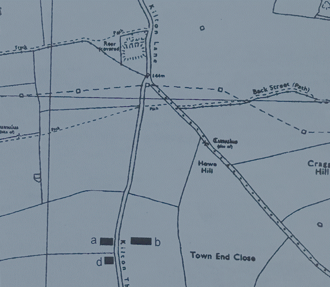
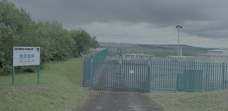
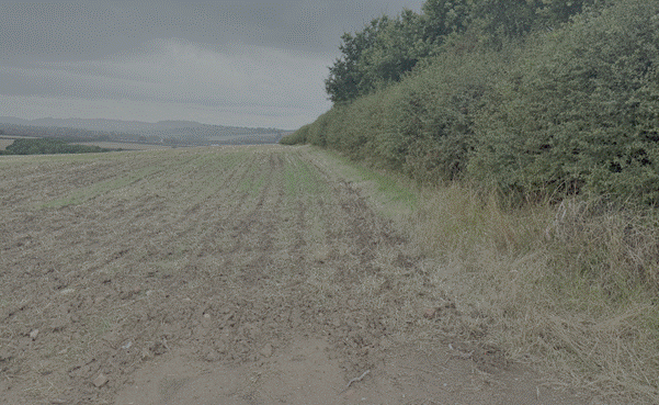
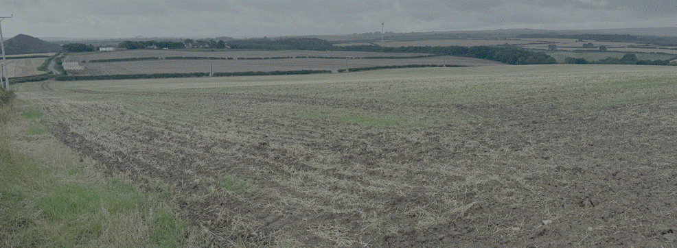
Site of Kilton Thorpe Iron
Age Village, taken 2026 (by the author)
The Pressure Regulating
Installation owned and operated by ESP Utilities Group Limited is a secure,
specialised above-ground assembly of gas utility infrastructure. It safely
drops the high or medium pressure of natural gas coming from the upstream distribution
network down to a stable, low pressure.
The Iron Age village at Kilton Thorpe
Lane comprised ten prehistoric houses and could be considered
to be an open village in the sense that it is not enclosed by a
substantial bank and ditch. Whilst enclosed Iron Age villages have been
recognised by aerial photographs south of the River Tees and as
earthworks on moorlands as at Great Ayton Moor, open villages like
Kilton Thorpe are rare in North East Yorkshire.
The earlier excavations in 2000 and 2001 had been restricted in area to the
extent of the development, but it was clear that the Iron Age village extended
beyond these developments to both the north and the south. The excavation in
2002 was sited 6 m south of the area excavated in 2000, in the adjoining
field to see if the village extended much further to the south. (Sherlock, Stephen J
(2002), An Archaeological Excavation at Kilton Thorpe, near Brotton,
Excavations during August 2002).
The excavation has found the
southern limit of the Iron Age village whilst the excavation has found the
ditches and features found in 2000 continued to the south, demonstrating that
the ditches and features found in the area opened in 2002. However, no further
structures were found in the area opened in 2002. Furthermore
two trial trenches, 2m wide extended south from the limit of the excavation for
a further 12m and they did not reveal any further features. The features discovered
in the excavation are thought to represent a driveway and ditches that were
part of a prehistoric landscape that formed an entrance to the village. The
driveway may well have been created as part of a process of organising and
managing the Iron Age landscape. The driveway would have allowed access into
the village from the surrounding fields and communities. There was ceramic from
the driveway ditches and some evidence for prehistoric cereals form the soil
samples within the ditches. However, the small amounts of pottery and cereals
would suggest that these features are on the edge of the settlement rather than
at the nucleus. Driveways and tracks leading into Iron Age villages have been
recognised elsewhere, at Thorpe Thewles a trackway led from the south towards
the unenclosed settlement (Heslop, DH (1987), The Excavation of an Iron
Age Settlement at Thorpe Thewles, Cleveland 1980 to 1982, CBA Research Report
65, London, figure 34). Recent excavations at Long Newton
have exposed a series of ditches that delimit a trackway leading from a stream
northward to the possible settlement (Sherlock forthcoming). One feature of
note is the relationship of the southern gully 20 to driveway boundary 47 the
alignment is similar and they both terminate at the same point on the west, this is similar to a feature
excavated in 2001. The excavations in 2001 exposed a long ditch with a narrow
gully, feature 168, adjacent on the same alignment. In the case of the ditch
and gully excavated in 2001 it was proved that the narrow ditch 168, was cut by
the larger boundary ditch. The suggestion is that ditch 168 was earlier and may
have been marking out boundaries that were later reflected and respected when a
more substantial boundary was created (Sherlock and Vyner (2001), Brotton-Boulby Pipeline, The Iron Age Settlement at Kilton Lane,
Brotton. Tees Valley Archaeology, page 5). It is suggested that
gully 20 excavated in 2002 may form a similar function to gully 168 in 2001, in
that it is an earlier feature that the later farmers could respect and use. The
date of feature 20 is unknown although it could still be Iron Age in date for
two reasons. Firstly the gully is respected in terms
of alignment possibly because it is still in use as a boundary, secondly whilst
no dating material was recovered from this ditch, Iron Age pottery was found in
feature 168, the comparable ditch to the north. (Sherlock, Stephen J
(2002), An Archaeological Excavation at Kilton Thorpe, near Brotton,
Excavations during August 2002).
The excavation has
established the southern limits of an open style of Iron Age village similar to that at Thorpe Thewles (Heslop, DH (1987), The
Excavation of an Iron Age Settlement at Thorpe Thewles, Cleveland 1980 to 1982,
CBA Research Report 65, London). The settlement here at
Kilton Thorpe is thought to date to the Late Prehistoric period although there are
no recognisable Romano-British influences. The radio-carbon dates for the site
excavated in 2000 range from 2230 + or - 55 (OxA10518) to 1955 + or - 45 (OxA 10655), whilst the ceramic evidence is in accord with
those dates. There are other unenclosed Iron Age settlements in the area at
Roxby and on Percy Rigg, but they are different in that they lack the evidence
for cereal production. At Roxby four prehistoric roundhouses were recorded
adjacent to a track that is thought to be a long distance
route from the North York Moors to the coast (Inman et al. 1985). The site on
Percy Rigg noted an unenclosed settlement of five houses, only two of which are
thought to have been contemporary, Percy Rigg is also adjacent to a long distance moorland track (Close, R (1972),
Excavation of Iron Age Hut Circles at Percy Rigg, Kildale, Yorkshire
Archaeological Journal, Volume 44, pages 23 to 32). There
are Iron Age sites nearer to Kilton Thorpe that add to our knowledge about the immediate
landscape around the parish of Skelton and Brotton. During the creation of the
Skelton‑Brotton bypass in 1999
traces of Iron Age fields were discovered approximately 500m north of the
present site (ASUD, 1999). A further site is known from aerial photography at
Craggs Hall; here a subrectangular enclosure has been
recognised (Vyner, personal commication). The
gas pipeline from Brotton–Boulby Potash Mine was sited in the field to the south of the cropmark where trial
excavations in 2001 revealed a single linear gully containing Iron Age pottery
(Sherlock
and Vyner (2001), Brotton-Boulby Pipeline, The Iron
Age Settlement at Kilton Lane, Brotton. Tees Valley Archaeology). The
Craggs Hall enclosure is undated but similar cropmark enclosures at Thorpe
Thewles and Foxrush Farm, Redcar have proved to be
Iron Age upon excavation. Clearly the site village at Kilton Thorpe is part of
a landscape that is intensively occupied by the end of the Iron Age (70 AD).
The Tees Valley has been intensively farmed since Late Prehistoric times (Haselgrove, CC (2001), The
Later Bronze Age and Iron in the Lowlands, in Past, Present and Future, The
Archaeology of Northern England, pages 45 to 69, Architectural and
Archaeological Society of Durham and Northumberland, Research Report Number 5,
page 57) as is suggested by the evidence from the Sites and
Monuments Record for Teesside that shows there are 90 known Iron Age sites within
the former area of Cleveland County. The excavations at Kilton Thorpe should
perhaps be seen as an opportunity to glean an insight into the Iron Age
landscape south of the River Tees. In this respect there is still further work
to do before the wealth and economy of the area is fully understood. Two
further questions that need to be resolved in connection with the site at
Kilton Thorpe are how much further to the north does the site extend and how does
this site relate to the other sites in the immediate area to the NE. The first
question could be resolved by further excavations to the N of the area
excavated in 2001 to find the limit of the Iron Age settlement; this could then
provide a plan to show the extent and limits of the known site. In the longer
term a programme of fieldwork at Craggs Hall may provide dating, environmental
and cultural material that will allow comparisons to be made with the site at
Kilton Thorpe. (Sherlock, Stephen J (2002), An Archaeological Excavation at
Kilton Thorpe, near Brotton, Excavations during August 2002).
The 2000 and 2001
excavations relate to the same site, namely an Iron Age village which, over
the two campaigns of excavation, have presented evidence for at least nine
prehistoric roundhouses. The Northern Archaeological Associates excavations
revealed six circular structures within boundaries and fields that were
adjacent to Kilton Thorpe lane (Abramson, P (2001), An Iron Age Settlement at Kilton Thorpe,
Cleveland, Teesside Archaeological Society Bulletin, Volume 6, pages 4 to 8). The structures all
had entrances facing east as is common in Iron Age buildings whilst one of the
buildings, structure 1, had remains of a hearth and possibly a floor surface.
The principal finds from the excavation were prehistoric pottery and a quern,
or corn grinding stone. Unfortunately metalwork and bone
did not survive, possibly because of the acidic soil, however, evidence was
recovered for the cultivation of cereals and it was
possible to obtain radiocarbon dates for the site that date the occupation from
about 200 BC.
The excavations in
2001 revealed evidence for a further three round houses with a suggestion of a
fourth ring ditch very near Kilton Thorpe lane. In addition to the houses
further field boundaries were revealed, the most prominent of which seems to form
an enclosure or boundary ditch that at one time delimited the site.
Interestingly, two of the round houses found in 2001 were outside the enclosure
and it seems the enclosure ditch had been backfilled and then an open
settlement extended across the hillside. A similar feature was noted at the
Iron Age village at Thorpe Thewles (Heslop, DH (1987), The Excavation of an Iron Age Settlement at
Thorpe Thewles, Cleveland 1980 to 1982, CBA Research Report 65, London) during the later phase
of occupation of the site, c 100 BC. The finds from the second year at Kilton
Thorpe were similar to those in 2000, namely
prehistoric pottery and some pieces of Flint. Two finds were of particular
interest, a shale or jet spindle whorl and a piece of decorated stone found in
a post hole in House 2. The evidence for plants and cereals suggested that this
site was a self-sufficient producer site, particularly of spelt wheat, whilst
for heath grasses was also found.
The excavations over two
seasons have demonstrated that a substantial Iron Age farmstead existed at
Kilton Thorpe and the full extent of the site has yet to be established. A
recent national survey of the British Iron Age (Hazelgrove etal
(2001), Understanding the British Iron Age, an Agenda for Action) has identified
priorities for action in studying Iron Age settlement. Among the
recommendations are to examine what is happening beyond the enclosure or
settlement and to obtain more carbon dates from sites. There are other questions
that need to be answered such as what relation what is the
relationship between adjacent sites and to try to understand more about
the settlement within the enclosure. Some of these research questions can be
addressed by excavation outside the areas currently excavated at Kilton Thorpe.
(Sherlock, Stephen J (2002), Excavations
at Kilton Thorpe in 2002).
The best preserved of
the roundhouses was Structure 1 situated on the east edge of the site and continuing
beyond the limit of the excavation area. The circular ditch measure c 6 m in
diameter and within this the remains of a hearth and several postholes were
recorded. A small, heavily disturbed area of sandstone cobbles in the extreme
eastern area of the structure may have been the only surviving trace of a floor
surface, The entrance to the structure may have been from the southeast, a
feature probably common to the neighbouring houses in the southern part of the
site.
It is tempting to view
the site as comprising a group of single phase
structures each situated within its own irregular enclosure. The relatively
short period of use implied by a single phase of activity contrasts with the
evidence from the Iron Age site at Thorpe Thewles (Heslop, DH (1987), The Excavation of an
Iron Age Settlement at Thorpe Thewles, Cleveland 1980 to 1982, CBA Research
Report 65, London), some 30 km to the west where the complex stratigraphy
clearly pointed to multiple phases of construction. At Catcote,
3km southwest of Hartlepool (Long, CD (1988), The Iron Age and Romano British Settlement at Catcote, Hartlepool, Cleveland, Durham Archaeological
Journal, Volume 4, pages 13 to 55), the site was occupied for more than 600
years, spanning the Iron Age and Romano-British periods. It is of course
possible that at Kilton Thorpe evidence for re-use of the site has been
destroyed by ploughing, or, the settlement ‘shifted’
and earlier or later phases of the site await discovery in the surrounding
fields. Indeed, several hundred metres to the north of the site a large
enclosure, measuring 90m by 80m was sample excavated during the construction of
the Skelton to Brotton bypass (Wardle, S (2000), Skelton-Brotton Bypass: Archaeological
excavation undertaken on behalf of Redcar and Cleveland Borough Council,
Northern Archaeology Associates 00/15). Although no evidence of settlement
activity was recorded in the enclosure, it was considered to
be of Iron Age or Romano-British date and its proximity to the Kilton
Thorpe Iron Age settlement suggests a possible relationship between the two
sites.
Fortunately at Kilton Thorpe not
all of the deposits had been truncated and, unusually
for Iron Age sites in the region, a sizable assembly of pottery was recovered
from the site. Blaise Vyner has undertaken an assessment of the assemblage
prior to a more detailed analysis. His provisional findings are very
interesting. Kilton Thorpe has provided one of the largest assemblages of later
prehistoric pottery to be recovered from excavation in Yorkshire and northeast England, and is of particular value
because of the paucity of other Iron Age pottery assemblages from northeast
Yorkshire. The assemblage appears to belong to the middle or later part of the pre Roman Iron Age, dating perhaps from the 4th or 5th
century BC. The absence of Romano British pottery suggests that activity in the
excavated area had ended by the 1st century AD.
Although limited by
comparison with the extensive assemblage from Thorpe Thewles, nevertheless the
pottery assemblage from Kilton Thorpe is larger than all other Tees Valley Iron
Age assemblages. Existing pottery assemblages include the mainly Iron Age material
from Eston Nab, as well as later pottery from Dixons Bank, Nunthorpe. Both
sites lie some to the north of Kilton. Apart from a few small assemblages from
the sites on the moorland fringe, among them Percy Rigg and Great Ayton Moor,
there is little in the way of local comparative material. In terms of size,
this collection of pottery finds its best comparator in the recently excavated
assemblage from Brampton, North Yorkshire. The material thus represents an
important addition to knowledge of later prehistoric settlement and ceramics in
the area.
Kilton Thorpe is one
of only a handful of excavated Iron Age sites in Cleveland.
(Abramson, P (2001), An Iron Age Settlement
at Kilton Thorpe, Cleveland, Teesside Archaeological Society Bulletin, Volume
6, pages 4 to 8).
c 50
BCE to c 50 CE
In the wider
Cleveland area, Iron Age farmsteads and enclosures reflect dispersed settlement
patterns on fertile boulder clay soils, with pollen evidence suggesting forest
clearance and arable expansion from the late Bronze Age onward.
A pottery assemblage from Kilton Hall included the lower part of a
handmade Iron Age cooking jar (Robert Daniels.
1990. Kilton: A Survey of Moorland Fringe Township in Medieval Rural
Settlement in Northeast England. Architectural and Archaeological Society
of Durham and Northumberland Research Report No 2, edited by B E Vyner, page 43).
The Crag Bank
Iron Age and Romano-British settlement is a significant archaeological site
located in Kildale. The inhabitants practiced mixed farming with evidence of
iron smelting and smithing, and large numbers of beehive quern stones used for grinding
grain. Occupation began in the Late Iron Age, the settlement continued to be
used into the Romano-British period. (Close, RS,
Hayes, RH and Spratt, DA. 1975. Romano-British Settlements at Crag Bank and Lounsdale, Near Kildale North Riding in Yorkshire
Archaeological Journal Volume 47, pages 61-68).
70 CE
Romano-British
activity
This area was
part of the realm of the Brigantes, which stretched from the Peak district
north to the Tyne and coast to coast. At first the Brigantes accepted a client
state position under the Romans but later tensions
mounted leading to the Roman march north.
In about 71 CE,
the Roman legions
were ordered North, made their headquarters at Eboracum (York) and
defeated the Brigantes at Stanwick, near Richmond. Forts were established at
Malton, Catterick and Aldbrough. Northern England was
to remain under Roman rule for the next 350 years.
Second
Century CE
Roman influences
in the Cleveland region included low-level farmstead occupation and integration
into local networks, though no major Roman sites have been identified in or
around Kilton. The area's peripheral position relative to military routes like
Dere Street limited intensive development, with continuity from Iron Age
practices evident in artefact assemblages lacking finewares
or coins.
It seems likely that
Iron Age folk continued to live much as before the Roman occupation,
increasingly abandoning the moors which had become less fertile. Nevertheless the Roman army had insatiable appetite for
goods taken to market and tribal warfare between tribal bands was likely to
have been supressed (Spratt,
D A. 1979. The Archaeology of Cleveland).
Wade’s Causeway was constructed in the early
second century which may have increased communication to the areas north of the
moors.
Third
Century CE
There are no
known Roman villas in Cleveland, but the third century CE probably brought
peace and greater prosperity. A third century CE copper alloy Roman cavalry
helmet was found at Guisborough. The deities depicted on the brow-plate include
Victory, Mars and Minerva. (British Museum number 1878,0910.1;
Dim, David and Kaminski, Jaime. 2017. The Production and Deposition of the
Guisborough Helmet in Arms and Armour Volume 14, pages
1-33; Archaeologist
on a mission to raise awareness of Guisborough discovered historic Roman helmet,
16 September 2017, Darlington and Stockton Times). Whilst there were Roman
period settlements in the area, these were probably more continuations of the
Iron Age culture in this area. This was far from Roman military activity.
Fourth
and Fifth Centuries CE
Its relative
isolation may have meant that Cleveland was not so directly impacted by the
Roman withdrawal as the area south of the moors towards Eboracum (York).
Cleveland had formed part of the military zone of Roman Britain but had
never enjoyed the same degree of wealth and civilisation that had been widespread
in the southern part of the country. It did not offer a particularly tempting
prospect for those seeking booty, and in the 5th
century may well have suffered more from internal disputes than external
threats. (Spratt, D A.
1979. The Archaeology of Cleveland).
 Â
 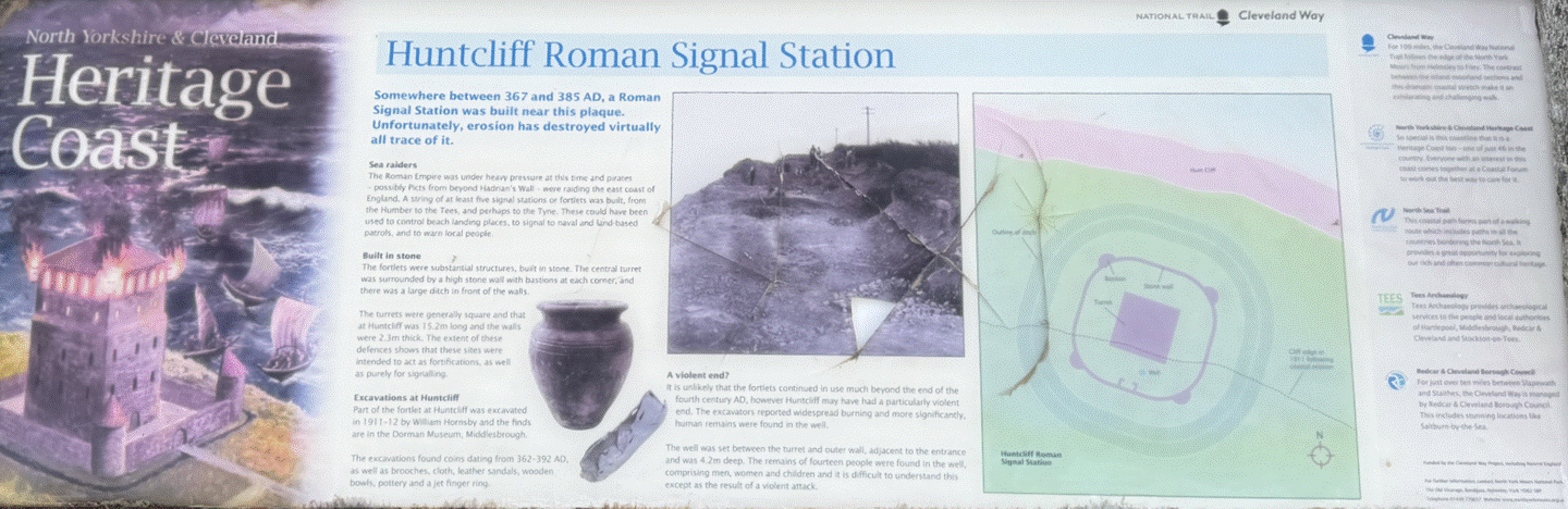
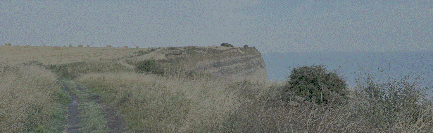
Roman coastal
Signal Station at Huntcliff (by the author, 2026)
Huntcliff Roman
Signal Station. Somewhere between 367 and 385 AD, a
Roman Signal Station was built on Huntcliff. Unfortunately, erosion has destroyed
virtually all trace of it. The Roman Empire was under heavy pressure from sea
raiders attacking from beyond Hadrian’s Wall and along the east coast of
England. Among a number of signal stations were built,
from the Humber to the Tees, and perhaps to the Tyne. These could have been
used to send messages by means of visual and land-based communication. The
fortlets were small structures, built in stone. The central tower was surrounded
by a high stone wall with bastions at each corner; all were topped with timber
fighting platforms. The turrets were generally square and the fortlets were
manned by small garrisons of soldiers. Life was probably hard and monotonous,
with duties including maintenance of the fortlet, lookout, and signalling. Part
of the fortlet at Huntcliff was excavated in 1911–12 by William Hornsby and R.
H. Forster. The excavations found coins dating from 367–392 AD, bowls, jars, and
a large iron knife. It is unlikely that the fortlets continued in use much
beyond the end of the fourth century AD; however, Huntcliff may have had a
particularly violent end. The excavators reported widespread burning and more
significantly, human remains were found in the well. The well was set between
the tower and outer wall, adjacent to the entrance, and was 24m deep. The
remains of fourteen people were found in the well, comprising men, women, and
children, and it is difficult to understand this except as the result of a
violent attack. (North Yorkshire and Cleveland
Heritage Coast).
Anglo-Saxon
Kilton
The site of
Kilton Thorpe, a place of occupation since the Iron Age, continued to be
occupied as a settlement (Medieval
settlement and open field system at Kilton Thorpe, National Heritage List 1019915 listed in 2001 at NZ
689176).
 Â
Â
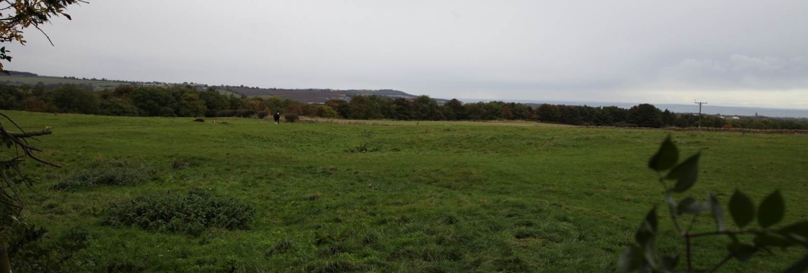
Ridge and farrow
corrugation at Kilton, taken in 2016
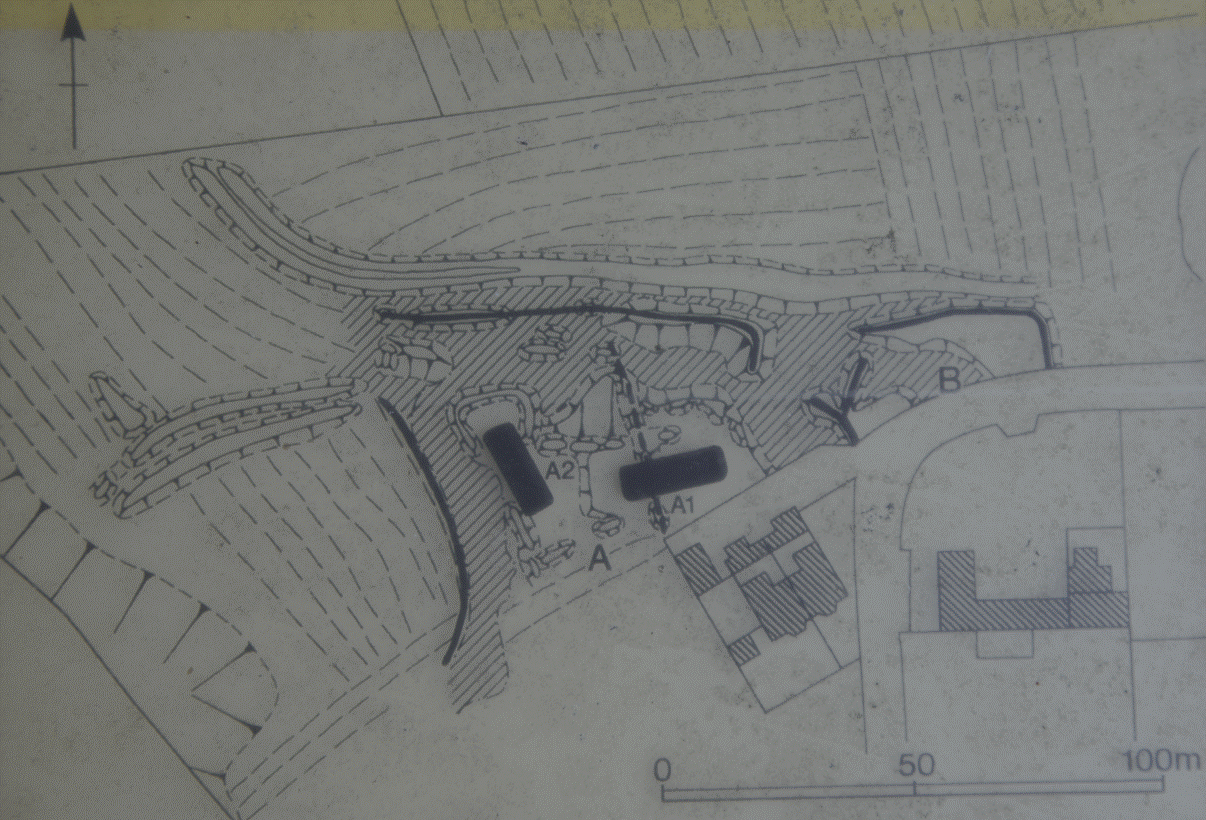
The earthworks at
Kilton Thorpe are complicated and it should be remembered that they are the
remains of at least 500 years of activity. In addition
the construction of the present road and buildings have destroyed a large
portion of the remains making it difficult to interpret what survives. It is
suggested that the earthworks are those of two farmsteads A and B and that A
has at least two phases of earthworks. The lighter hatched areas are low-lying eroded
pathways through and around the farmsteads. The boundaries around the farms
were probably a mixture of hedges and fences and farm A has two routes out into
the fields, one of which is shared with B. A central area within A contains
platforms on which buildings probably stood. A1 was probably the earliest site
and a later farmstead A was reduced in size and a new boundary and building
established A2. The main buildings in the farmsteads would have been
longhouses, about 20 metres long and 7 metres wide with a central doorway. To
one side of the doorway was the living room of the family, while the other side
would have been used as a cattle byre creating medieval central heating. The
longhouses would be of crock construction with thatched roofs and low clay and
stone walls and their possible position is shown on
the plan of the earthworks. A map of 1765 shows the present road at Kilton Thorpe.
The medieval farms had probably been abandoned by the 17th century. (Local information at Kilton Thorpe).
The medieval landscape at Kilton evolved from farmstead to hamlet
to village, each associated with areas of ridge and furrow reflecting the
agricultural economy. Milling emerged at Kilton mill to the north
east. The road from Brotton to Kilton is almost certainly of medieval
origin. Apart from the wooded valleys to the east, the whole area was
cultivated at some stage. (Robert Daniels. 1990. Kilton:
A Survey of Moorland
Fringe Township in Medieval Rural Settlement in North
East England. Architectural and Archaeological Society of Durham and
Northumberland Research Report No 2, edited by B E Vyner, page 33, page 41).
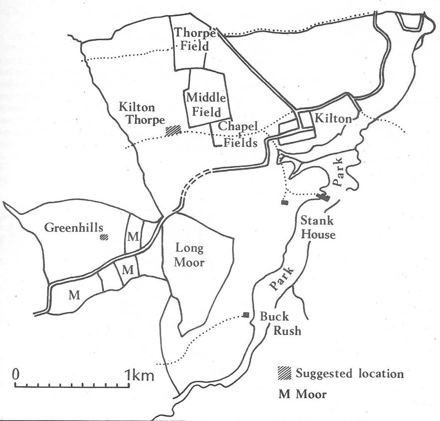
Reconstruction
of the medieval landscape of Kilton (Robert
Daniels. 1990. Kilton: A Survey of Moorland Fringe Township in Medieval
Rural Settlement in North East England.
Architectural and Archaeological Society of Durham and Northumberland Research Report
No 2, edited by B E Vyner, page 49)
By the mid sixth
century cultural corelands emerged in the lands of
Deira and Bernicia, in agricultural heartlands in such places as the Lower Tyne
Valley and the Vale of Pickering, which had once formed the Romano-British
landscape (Roberts, Brian. 2010. Northumbrian
Origins and Post Roman Continuity: an exploration in Finds from the Frontier:
Material Culture in the 4th – 5th centuries, Council for Archaeology Research
Report 162, page 123). The kingdom of Deira comprised the lands south of
the Tees which stretched over the moors and across the vales to the Yorkshire
Wolds (P Hunter Blair. 1949. The boundary
between Bernicia and Deira in Archaeologia
Aeliana, Series 4, Volume 27, pages
46 to 59). The future Kilton found itself in the borderlands between the
composite kingdoms of Deria and Bernicia, which over time fused into
Northumbria.
In about 650 CE,
in the northern lands of Deira which Norsemen would later rename Cliff-land, a
high-status woman was buried at the
Street House site in a lavish bed burial, overlooking the sea, with her
exquisite jewellery (Kirkleatham Museum. Street House
Exhibition. Adams, Max, and Colm O’Brien. 2025.
Northumbria AD 367–867. Edinburgh: Birlinn.
Page 105). This
Anglo-Saxon aristocrat, perhaps a Deiran princess, reflected the richness of an
emerging Northumbrian culture. The Anglo-Saxon
Street House Burial is evidence of the continuing importance of the nearby
site on the coast.
An isolated fifth
to sixth century bronze penannular brooch, perhaps Romano-Brittonic from the
transitional age to Anglo-Saxon dominance, was found at Yarm and there were
finds of burials and cremations at Hob Hill near Saltburn, perhaps an outlying
group of settlers in the far north of Deira (Anglo-Saxon
Teeside, Tees
Archaeology, 2020; Spratt,
D A. 1979. The Archaeology of Cleveland; Gallagher, DB. 1987. The Anglo-Saxon
Cemetery at Hob Hill, Saltburn in Yorkshire Archaeological Journal, Volume
59, pages 9-29). The Dorman Museum has
artefacts excavated from the Anglo-Saxon cemetery at Hob Hill.
865 CE
Scandinavian
influence
From place name
evidence Cleveland was one of the areas of Northumbria most densely settled by
the Vikings. It
was they who gave the name Cleveland to the area, though judging from later
saga references, it extended from the River Tees to Scarborough in the south.
(Spratt, D A. 1979. The
Archaeology of Cleveland). The name Cleveland appears to derive from the Old English word clifa land or the Old Norse Kliflond. The Vikings named it land of cliffs
because of the dramatic, steep terrain of the coastline where the hills from
the North York Moors meet the North Sea. The name was deeply embedded in the region's history and it was recorded in the 12th-century Orkneyinga Saga.
When the brothers
Paul and Erlend had succeeded to the government of the Orkneys, King Harald
Sigurdson (Hardradi) came from Norway with a large
army. He first touched Hjaltland; from thence he went
to the Orkneys, and left there his Queen Ellisif, and their daughters Maria and
Ingigerd. From the Orkneys he had many troops; both the Earls went with him on
the expedition. He went from Orkney to England and landed at a place called Klifland (Cleaveland), and took Skardaborg
(Scarborough). Then he touched at Hallarnes
(Holderness), and had a battle there, in which he was victorious. The Wednesday
next before Matthiasmas (20th September) he had a
battle at JórvÃk (York) with the Earls Valthióf and Mórukári. Mórukári was slain there (Hjaltalin,
Jon A and Goudie, Gilbert (translated from Icelandic). 2018. The Orkneyinga Saga. Chapter 24)
Located on the edge
of the North York Moors and vulnerable to North Sea coastal raids, the hamlet
at Kilton remained a quiet farming settlement. It was situated near the deep
ravine of Kilton Beck, a steep valley that later made an excellent defensive
position. The settlement was recorded in the Domesday Book as Chitun. Chitune is
probably derived from Old English cild tūn, sometimes cilda-tun
meaning farmstead associated with the young men or freemen. Place-names
ending in -ton suggest an Anglo-Saxon foundation, likely dating back to
the arrival of Germanic tribes in the 5th to 7th centuries. Another
interpretation of the name points to an Old English/Old Norse translation of narrow-valley
farm. The name may be a combination of Old English and Old Norse. The Ch-
shifted to K- under Scandinavian linguistic influence. The name Kilton
may be derived from Norse language and may therefore refer to a farm settlement
in a narrow valley. The suffix -ton was later commonly adopted or "Scandinavianised" into the local lexicon following
Viking invasions and the establishment of the Danelaw in the ninth and tenth
centuries.
Kilton Thorpe is
mentioned in the Domesday Book as Thorpe. Thorpe is a Scandinavian word for a
small settlement and the use of this name indicates
that there were a number of Scandinavian farmers in
the area. Thorpe names are very common in Yorkshire and medieval clerks added
the Kilton element to the name as a distinction. Since there were many Thorpes in
northern England, the settlement became known as Kilton Thorpe. The use of the
name Thorpe suggests that Kilton was a more important settlement.
Freeborough Hill is a prominent, conical
landmark near Moorsholm. While the hill itself is a
natural geological formation, its distinctive shape made it a focal point for
prehistoric communities, and the surrounding Moorsholm landscape is rich with Bronze
Age barrows and ancient activity, including the Black Howes.
Early names suggest the hill may have been called Freyasberg or
Freya's Hill, dedicating it to the Norse goddess of love and war but it may
derive from Old Norse frithborh, referring to a frankpledge or surety in
legal assemblies, possibly suggesting its early use as a meeting or boundary
site. John Hall Stevenson of Skelton Castle later mischievously raised
speculation that Freebrough Hill was immortal Arthur's tomb.
1086
Norman
Conquest
When recorded in
the Domesday Book in 1286, Chitune (Powell-Smith, Anna. Open Domesday. Kilton)
comprised a principal settlement of 2 ploughlands, with 8 acres of meadowland,
which was held by Thorkil prior to the Conquest and directly by King William
after the Conquest. It was described as wasteland before and after the
Conquest.
Chitune also comprised
0.5 ploughlands, held by Uhtred prior to the Conquest and Count Robert of
Mortain after the Conquest.
 Â
  Â Â
 Â
Kilton Thorpe (Torp)
was recorded separately as two separate holdings each of one ploughland (Powell-Smith, Anna. Open Domesday. Kilton Thorpe).
As with Chitune, the first was held by Thorkil
prior to the Conquest and then by King William; and the second was held by
Uhtred prior to the Conquest and later by Count Robert of Mortain. Again this land was described as waste before and after the
Conquest.
 Â
 
Hence it is
apparent that in 1087, with the exception of one bovate in Stanghow, half a
carucate in Great Moorsholm, two carucates and a half at Kilton Thorpe, and
three carucates at Kilton, which were in the King’s hands, and of the Kilton
portion of which Torchil was the tenant, the entire
parish or district of Skelton, comprising thirty two carucates all but one
bovate, had been granted to Robert, Earl of Mortain, and was held of him by
Richard de Surdeval. (Atkinson, Rev J
C. History of Cleveland Ancient and Modern. Volume 1. Barrow in Furness:
J Richardson. Page 317).
Robert Earl of Mortain
Lands in both
Kilton and Kilton Thorpe were thus held for the King by the Count of Mortain.
Robert, Earl of Mortain and Cornwall, son of William the Conqueror’s mother by Herlewine de Conteville and so half brother of William, was granted 215 manors in
Yorkshire many in Cleveland. He subinfeudated many manors in Cleveland to Richard de Surdeval. The House Mortain later lost possessions due to
conspiracy against William 1088, but Surdeval kept
his manors as tenant in chief. It has been suggested that it was Surdeval who built Skelton Castle.
Robert, Count of Mortain (c 1031 to 8
December 1090) was the half brother of William the Conqueror and one of the
greatest landholders in England after the Conquest, holding some 797 manors. He
is known to have faught at the Battle of Hastngs and is pictured in the Bayeux
Tapestry at Pevensy seated with his brothers William and Odo.
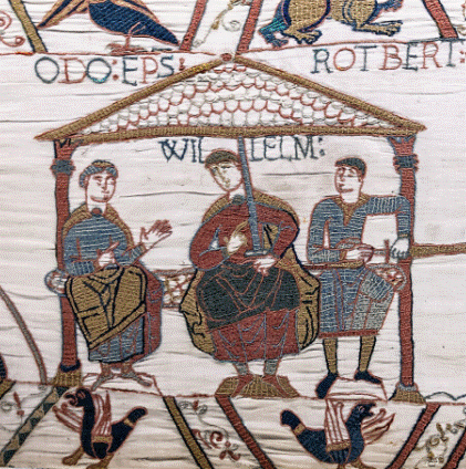
From the Bayeux Tapestry
In 1069, together with Robert of Eu,
Robert led an army against a force of Danes in Lindsey and effected great
slaughter against them (George Edward Cokayne. 1913. The
Complete Peerage of England Scotland Ireland Great Britain and the United Kingdom,
Extant Extinct or Dormant, Volume 3, Edited. Vicary Gibbs. London: The St.
Catherine Press, Ltd. Page
428).
Nearby Broctune, later Brotton, was a settlement of 11
ploughlands with 9 villages, 1 lord’s plough team and 4 men’s plough teams,
with 22 acres of meadow. It was also in the possession of Uhtred before the
Conquest and Richard of Sourdeval in 1086 with Robert
of Mortain as his tenant in chief. (Powell-Smith,
Anna. Open Domesday. Brotton).
Other settlements in the locality, all within the Hundred
of Langbaugh, were Loftus and Little Moorsholm
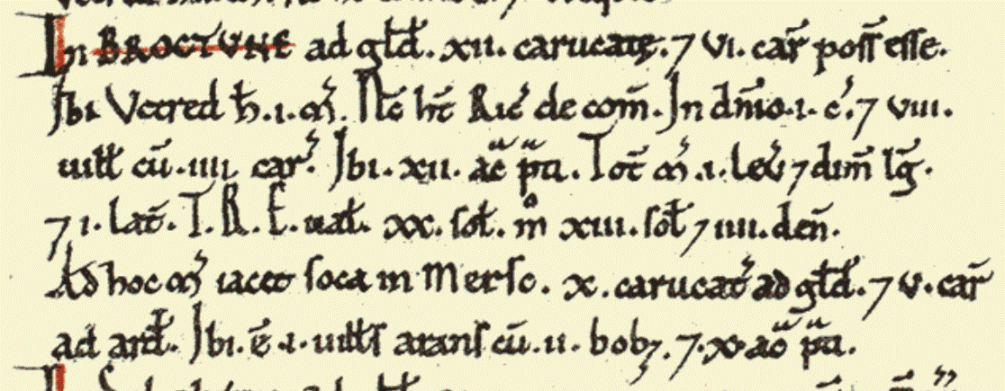 Â
    Â
   
Domesday
Book tells us that in 1086 the King held land at both Kilton and Kilton Thorpe.
In Kilton Thorpe there was a small manor of two and a half carucates, and at
Kilton there was a manor containing three carucates of land and eight acres of
meadow. The Count of Mortain also held land there. In Kilton Thorpe he had a
small manor of one and a half carucates, and in Kilton one carucate.
(The Origin and Early
History of the Kilton Fee, W Hebditch,
1939, Yorkshire Archealogical Journal, Volume 34, page 297).
We cannot be
quite so sure that Little Moorsholm originally formed part of this fee. In
Domesday this small manor of one caracute was held by Richard de Surdeval of
the fee of the Count of Mortain. Its history in the twelfth century however is
not very clear; but it may possibly have been subinfueded with the Kilton
property, for when we next hear of it, in 1257, it is in the hands of Mamaduke
de Thweng, the then lord of Kilton. Admittedly this evidence is late, but it
does at least show that Little Moorsholm formed part of the Kilton fee before
the Brus partition of 1272. (The Origin and
Early History of the Kilton Fee, W
Hebditch, 1939, Yorkshire Archealogical Journal, Volume 34, page
298).
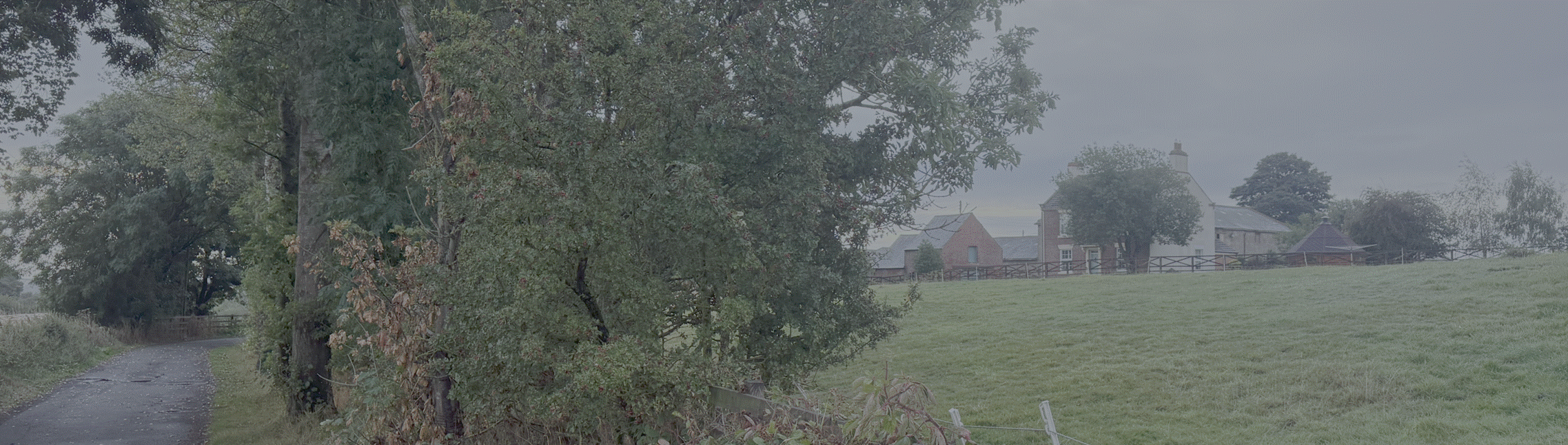
Little Moorsholm
Farm to the south of Kilton, 2026
Following the
Norman Conquest, Kilton emerged as an agricultural township tied to the nearby
parish of Brotton, with lands passing after 1088 from the exiled Count of
Mortain to Robert de Brus I, who consolidated holdings in Cleveland as part of
his barony centered at Skelton.
1090
Robert was succeeded by his son, William de Mortain (c 1084). From
childhood, he harboured a bitter dislike for his cousin Henry I and proudly
demanded from him not only his father's earldoms of Mortain and Cornwall, but
his uncle Odo, Bishop of Bayeux's Earldom of Kent. William of Malmesbury
described him as a person of shameless arrogance. The king kept putting
off William's demands for the earldom of Kent and instead offered him the hand
of Mary of Scotland, Queen Matilda's sister, which William promptly rejected.
He rebelled against the King with Robert de Belleme, but they were finally
defeated on 24 April 1106 at the Battle of Tinchebrai.
William was imprisoned for many years in the Tower of London, and in 1140
became a Cluniac monk at Bermondsey Abbey, across the River Thames from the
Tower of London. (George Edward
Cokayne. 1913. The Complete Peerage of England, Scotland, Ireland, Great
Britain and the United Kingdom, Extant Extinct or Dormant, Volume 3,
Edited. Vicary Gibbs. London: The St. Catherine Press, Ltd. Page 428).
On the death of Earl Robert of Mortain his son William succeeded
him in his earldoms of Moreton in Normandy, and Cornwall. In 4 Henry I (1104)
the King ‘seized upon all his possessions in England, razed his castles to the
ground and banished him from the realm’ for rebellious practices. In 1106 he
was taken prisoner in open war in Normandy and sent to England ‘there to be
secured during his life. After which, the King, causing his eyes to be put out,
bestowed his Earldom of Moreton on Stephen of Blois. (Atkinson, Rev J C. History of Cleveland
Ancient and Modern. Volume 1. Barrow in Furness: J Richardson. Page 317).
Robert de Brus (and
the potential interest of Alan de Percy)
1100
When William de Mortain was banished for conspiracy, it seems that
both villages at Kilton, the two and a half carucates, another five and a half
carucates and eight acres of meadow passed to Robert de Brus. The land around
Kilton and Skinningrove was given to the de Brus family, who had arrived
in England in or about 1094. At this time the manor of Little Moorsholm also formed part
of the Kilton Fee. That of Great Moorsholm did not join the Kilton Fee until
1272. It seems too that the Soke of South Loftus, six carucates of land, joined the Kilton Fee soon after the
Domesday survey. North Loftus was much bigger and was part of the Chester Fee.
Robert de Brus
is first named during the period 1094 and 1100, as a witness to a charter of
Hugh earl of Chester which is of very dubious authenticity (Chartulary of Whitby, n 25), granting
the church of Flamborough to the church of Whitby. Possibly the earl of Chester
about 1100-1104 enfeoffed Robert of certain portions of his Cleveland fee in
Lofthouse, Upleatham, Barwick, Ingleby, and other places. During the period
1103-1106 Robert de Brus attested with Ralph Paynell and 16 others a charter of
William, count of Mortain, to the abbey of Marmoutier. In 1109, at a council of
all England held at Nottingham, he attested the charter of Henry I confirming
to the church of Durham certain possessions which the men of Northumberland had
claimed. During the period 1109-1114 he was in possession of the lands late of
Orm, Turbern, Ulchil, Chetel, Ravenchil, and other English thegns in Borgescire
(Claro) wapentake and, as chief lord, consented to the gift made to the monks
of Marmoutier by Ralph Mauleverer, his tenant, of the chapel of Allerton
Mauleverer. About the same period he attested the charter of Henry I, issued at
Woodstock, confirming the above gift. When the Lindsey Survey was made
(1115-1118) he was in possession of the fee which William Taillebois had held
at the date of the Great Survey, namely Turvert’s manors in West Ashby, near
Horncastle, and Alford. It is a strong presumption from these circumstances
that Henry I had given Robert his Yorkshire fee soon after the battle of
Tinchebrai (28 September 1106). The enrolment of the details of this fee in the
Great Survey does not appear to have taken place until after 1120, because a
reference therein to Robert Fossard seems to indicate that Nigel Fossard, the
Domesday tenant in chief, was then dead, and that event did not occur until
after 1120. About the year 1131 Brus was in the retinue of Henry I at Lions, in
Eure. About the same time he attested with his 3 knights, Roger de Rosel, Guy
de Lofthus and Robert Francais, a confirmation of Alan de Percy to the monks of
Whitby. (Farrer. 1915. Early Yorkshire Charters. Volume 2. Page 11).
Farrer
included Kilton and Kilton Thorpe within the Brus fee before 1129, lands
formerly held by the Count of Mortain and Richard de Surdeval (Farrer. Early Yorkshire Charters. Volume 2. Page 19).
It is thus probable that as early as 1100 Robert de Brus
I held as tenant in chief that part of Kilton and Kilton Thorpe which in 1086
had belonged to the Count of Mortain (The Origin and Early History of the Kilton Fee, W Hebditch, 1939, Yorkshire Archeaological Journal,
Volume 34, page 297).
It is generally thought however that Robert de Brus received his Yorkshire fee
after the Battle
of Tinchebrai in 1106 (see
Farrer above). The Brus family thus came to hold large estates based on Skelton, Danby and in Kildale. (strike through text
shows elements of references which appear, with the benefit of contemporary
analysis, to be in error).
Castleton was the
centre of the de Brus estates in Cleveland, an estate which comprised 40
villages, which may explain why a large defensive work was constructed at
Castleton whilst a smaller ringwork was constructed at Castle Fevington, near Yarm (Cleveland). Sometime shortly
after 1104 Robert de Brus received the Skelton estate (Cleveland) from
Henry I, and the principal de Brus seat moved to Skelton from Castleton. (Excavations
at Castle Hill, Castleton, SJ
Sherlock, Volume 64, 1992, Yorkshire Archaeological Journal, Volume 64,
1992, page 41).
By the early 12th century, the
settlement at Kilton focused on mixed farming around farmsteads in Kilton Dale,
supported by meadow and ploughlands.
A medieval moor
edge settlement emerged around the large 13 carucate manor of Skelton, together
with a smaller manor of Moresum. However the township of Kilton had a slightly
different history from the rest of the Brus fee. (Barry Harrison. 1990. New Settlements in the North
Yorkshire Moors 1086-1340 in Medieval Rural Settlement in North East England. Architectural and Archaeological
Society of Durham and Northumberland Research Report No 2, edited by B E Vyner,
page 28).
On Farrer’s analysis, relying on a later
grant by Ilger of Kilton of land in Kirkleatham, by the mid twelfth century,
Kilton and Kirkleatham were part of the Kilton fee held by Brus. The greater
part of Kilton and Kirkleatham was held by Ilger de Kilton of the fee of Brus,
namely of that part of the fee of Brus which belonged at the Survey to the fee
of Mortain and previous to that had belonged to Uctred of Cleveland (Farrer. 1915. Early Yorkshire Charters. Volume 2. Page 67, Folio 722
and notes, see also page 68 Folio 723
and 724).
In this context the Kilton fee or
the Fief of Kilton refers to the whole landholding of the person, rather
than the place which later became Kilton itself. On Hebditch’s analysis, the Kilton
fee was a composite fee derived from more than one overlord. Kilton and Kilton
Thorpe was held until 1272 of the de Brus House. Kirkleatham was Westlidun
in the Domesday Book and later Lyum. In the Domesday Book Kirkleatham
had been divided between the King, Earl Hugh of Chester’s Fee, the Count of
Mortain’s Fee and William de Percy’s fee. The Kirkleatham lands were held
partly of the Percys but primarily of the de Brus overlords. (The Origin and Early History of the Kilton Fee, W Hebditch, 1939, Yorkshire Archealogical Journal, Volume
34, page 304).
The original fee comprised Kilton and Kilton Thorpe, part of Kirkleatham and
posssibly Little Moorsholm.
It appears that the Kirkleatham elemtn
of the Kilton fief led to an erroneous assumption of Kilton’s association with
the Percys.
1106
William L’Anson believed that by 1106, the township of Kilton had become part of the holdings of the Percys (L’Anson, William M. 1913. Kilton Castle in Yorkshire Archeaological Journal, Volume 22, page 57) (“The L’Anson Model